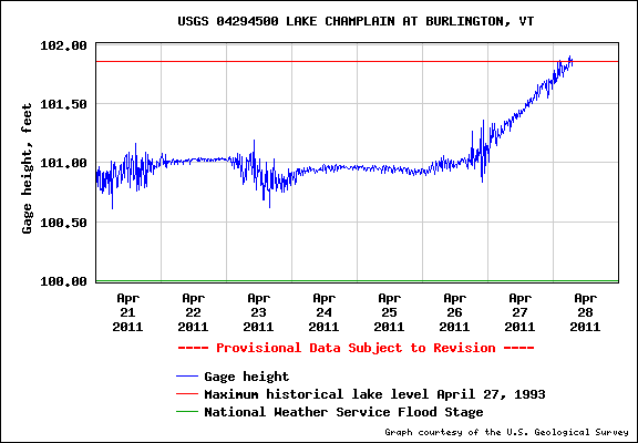
According to this USGS data for Lake Champlain we’re making history. To be more precise, Lake Champlain’s water levels are making history. That red line at the top of the graph is the historic high water mark set during spring flooding on April 27, 1993. And, as you can see, the blue “actual” recordings have already flickered above the red line a couple of times, though — as I understand it — these figures are not official. Yet. Not sure why. Nor when we’ll know the official water level, but I can assure you that Rosslyn boathouse is now swamped. And the lake is virtually windless and flat… Imagine what this afternoon will look like if/when the wind climbs into the high teens as forecast!
Fortunately there’s less debris floating around the boathouse today. I’m worried that heavy wave action combined with a large floating log or two acting as a battering ram against the boathouse superstructure could be devastating. We’ve witnessed the damage already when the water level was 18″ lower. I’ll head down when the rain abates to take some more images of the drowning boathouse to share with you. Until then, please send dry, windless vibes Essex-way. Thanks!
Leave a Reply